2023 Map of Montezuma
USGS Topo · Published 2023About this map
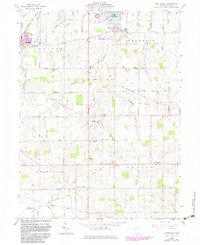
Montezuma sits at the southwestern edge of Grand Lake in this Mercer County landscape, where the waters of Montezuma Bay meet a grid of rural township roads. The area is defined by its deep Catholic heritage, evidenced by a dense network of parish centers including Saint Aloysious Catholic Cem at Carthagena and Saint Sebastian Catholic Cem near the settlement of Sebastian. The geography is remarkably flat, drained by systems such as Beaver Creek and Burntwood Creek, which flow toward the Wabash River in the south.
Find a feature on this map
89 named features on this map. Tap any name to fly to it.
Don’t see what you’re looking for? This feature index may not catch every label — zoom into the map to look around manually.
Map Details
Editions of this 2023 Montezuma Map
This is the sole edition of this map. No revisions or reprints were ever made.