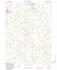
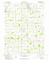
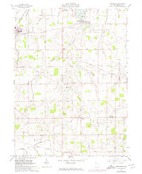
1961 Map of Montezuma
USGS Topo · Published 1983About this map
Montezuma and the southern shores of Grand Lake-St Marys anchor this West Ohio landscape in the early 1960s. The region is characterized by a dense grid of rural settlements and religious landmarks, including the prominent St Charles Seminary and St Aloysius Ch. Extensive conservation and recreation areas like the Mercer Waterfowl Management Area and Grand Lake-St Marys State Park dominate the northern lakefront, while the Norfolk and Western railway cuts through the northwest corner at Coldwater.
Find a feature on this map
58 named features on this map. Tap any name to fly to it.
Don’t see what you’re looking for? This feature index may not catch every label — zoom into the map to look around manually.
Map Details
Editions of this 1961 Montezuma Map
Other maps of this area

1908 · St. Henry
USGS Topo · 1:62,500

1909 · Loramie
USGS Topo · 1:62,500

1911 · Loramie
USGS Topo · 1:62,500

1911 · Spencerville
USGS Topo · 1:62,500

1914 · Celina
USGS Topo · 1:62,500

1944 · Loramie
USGS Topo · 1:62,500

1944 · Celina
USGS Topo · 1:62,500

1944 · Spencerville
USGS Topo · 1:62,500

1953 · Muncie
USGS Topo · 1:250,000

1956 · Muncie
USGS Topo · 1:250,000