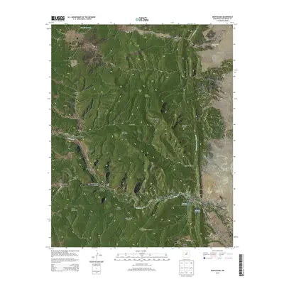
2013 Map of Montezuma
USGS Topo · Published 2013About this map
Gallinas Cr carves a deep path through the canyonlands of San Miguel County, anchoring a series of small settlements and mountain ranches. The community of Montezuma sits at a narrow point in the canyon, home to the Montezuma Seminary Cem and neighbors the historic thermal waters at Hot Springs. The landscape is defined by its complex drainage network, where Sanguijuela Arroyo and Cañada de Cerro Colorado feed into the higher elevations.
Find a feature on this map
47 named features on this map. Tap any name to fly to it.
Don’t see what you’re looking for? This feature index may not catch every label — zoom into the map to look around manually.
Map Details
Editions of this 2013 Montezuma Map
This is the sole edition of this map. No revisions or reprints were ever made.
Other maps of this area

1889 · Las Vegas
USGS Topo · 1:125,000

1891 · Las Vegas
USGS Topo · 1:125,000

1893 · Las Vegas
USGS Topo · 1:125,000

1954 · Santa Fe
USGS Topo · 1:250,000

1958 · Santa Fe
USGS Topo · 1:250,000

1961 · San Geronimo
USGS Topo · 1:24,000

1961 · El Porvenir
USGS Topo · 1:24,000

1961 · Montezuma
USGS Topo · 1:24,000
1961 · Ojitos Frios
USGS Topo · 1:24,000

1963 · Lake Isabel
USGS Topo · 1:24,000