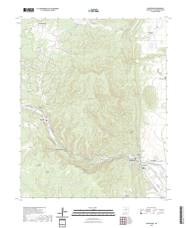
2023 Map of Montezuma
USGS Topo · Published 2023About this map
Gallinas Creek carves a deep valley through this San Miguel County landscape, serving as the primary corridor for settlements like Gallinas and Trout Springs. The terrain is defined by a dense network of canyons, including Jarita Canyon and Cañon Piedra Lumbre, which descend from the high ground of La Sierrita. This modern survey illustrates how water management continues to shape the region, with Peterson Reservoir and Bradner Reservoir situated near the community of Montezuma.
Find a feature on this map
42 named features on this map. Tap any name to fly to it.
Don’t see what you’re looking for? This feature index may not catch every label — zoom into the map to look around manually.
Map Details
Editions of this 2023 Montezuma Map
This is the sole edition of this map. No revisions or reprints were ever made.
Other maps of this area

1889 · Las Vegas
USGS Topo · 1:125,000

1891 · Las Vegas
USGS Topo · 1:125,000

1893 · Las Vegas
USGS Topo · 1:125,000

1954 · Santa Fe
USGS Topo · 1:250,000

1958 · Santa Fe
USGS Topo · 1:250,000

1961 · San Geronimo
USGS Topo · 1:24,000

1961 · El Porvenir
USGS Topo · 1:24,000

1961 · Montezuma
USGS Topo · 1:24,000
1961 · Ojitos Frios
USGS Topo · 1:24,000

1963 · Lake Isabel
USGS Topo · 1:24,000