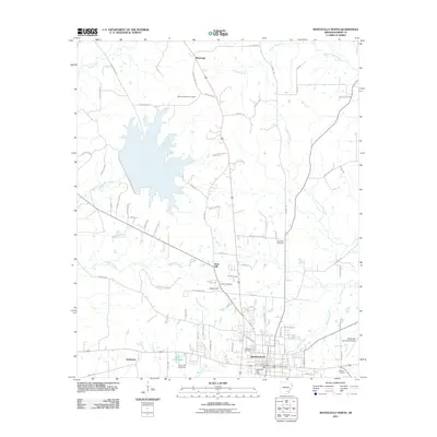
2011 Map of Monticello North
USGS Topo · Published 2011About this map
Monticello serves as the focal point of this Drew County landscape, where the town's expanding street grid meets the rural reaches of Southeast Arkansas. The geography is defined by a series of north-south drainage networks including Hungry Run Creek and Lower Cutoff Creek, which thread through timberlands and agricultural fields. Smaller settlements like Rose Hill and Montongo anchor the northern reaches of the quadrangle, connected by an intricate network of county roads such as Plantersville Rd and County Rd 94. For genealogists, the map preserves the locations of several burial grounds, including Oakland Cemetery and the more remote Mount Pleasant Cemetery. The presence of Dura Craft Lake and the nearby Dura Craft Lake Dam highlights local water management and recreation patterns typical of the region's late-twentieth-century development.
Find a feature on this map
85 named features on this map. Tap any name to fly to it.
Don’t see what you’re looking for? This feature index may not catch every label — zoom into the map to look around manually.
Map Details
Editions of this 2011 Monticello North Map
This is the sole edition of this map. No revisions or reprints were ever made.
Other maps of this area

1935 · Feenyville
USGS Topo · 1:62,500

1935 · Cominto
USGS Topo · 1:62,500

1935 · Rotan
USGS Topo · 1:62,500

1953 · Greenwood
USGS Topo · 1:250,000

1956 · Greenwood
USGS Topo · 1:250,000

1960 · Collins NW
USGS Topo · 1:24,000

1960 · Collins
USGS Topo · 1:62,500

1960 · Cominto
USGS Topo · 1:24,000
1964 · Tyro
USGS Topo · 1:24,000

1966 · Monticello North
USGS Topo · 1:24,000