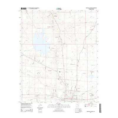
2014 Map of Monticello North
USGS Topo · Published 2014About this map
Monticello anchors the southern edge of this Arkansas landscape, where the town's expanding residential grid meets the wooded drainages of the West Gulf Coastal Plain. The northern reaches are defined by a network of smaller communities including Montongo and Rose Hill, connected by a web of local routes like Bill Henry Rd and Plantersville Rd. The area's agricultural and rural character is preserved in the numerous family and community landmarks, such as Rose Hill Cem and Mt Pleasant Cem.
Find a feature on this map
61 named features on this map. Tap any name to fly to it.
Don’t see what you’re looking for? This feature index may not catch every label — zoom into the map to look around manually.
Map Details
Editions of this 2014 Monticello North Map
This is the sole edition of this map. No revisions or reprints were ever made.
Other maps of this area

1935 · Feenyville
USGS Topo · 1:62,500

1935 · Cominto
USGS Topo · 1:62,500

1935 · Rotan
USGS Topo · 1:62,500

1953 · Greenwood
USGS Topo · 1:250,000

1956 · Greenwood
USGS Topo · 1:250,000

1960 · Collins NW
USGS Topo · 1:24,000

1960 · Collins
USGS Topo · 1:62,500

1960 · Cominto
USGS Topo · 1:24,000
1964 · Tyro
USGS Topo · 1:24,000

1966 · Monticello North
USGS Topo · 1:24,000