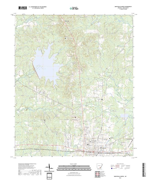
2024 Map of Monticello North
USGS Topo · Published 2024About this map
The northern reaches of Monticello serve as the focal point for this 2024 survey of Drew County, Arkansas. The landscape is defined by the headwaters of numerous waterways, including Hungry Run Creek and Godfrey Creek, which drain the undulating terrain around Gaster Hill. This modern map documents the contemporary layout of the city, highlighting the Drew County Courthouse at its heart and the Monticello Municipal Airport/Ellis Field on the eastern edge. Local history and genealogy are well-represented by several burial sites, such as Oakland Cem and the more remote Campground Cem near Montongo. The settlement pattern reflects a mix of established residential areas and more rural communities like Tennessee, connected by a network of county roads that navigate the area's many branches and creeks.
Find a feature on this map
99 named features on this map. Tap any name to fly to it.
Don’t see what you’re looking for? This feature index may not catch every label — zoom into the map to look around manually.
Map Details
Editions of this 2024 Monticello North Map
This is the sole edition of this map. No revisions or reprints were ever made.
Other maps of this area

1935 · Feenyville
USGS Topo · 1:62,500

1935 · Cominto
USGS Topo · 1:62,500

1935 · Rotan
USGS Topo · 1:62,500

1953 · Greenwood
USGS Topo · 1:250,000

1956 · Greenwood
USGS Topo · 1:250,000

1960 · Collins NW
USGS Topo · 1:24,000

1960 · Collins
USGS Topo · 1:62,500

1960 · Cominto
USGS Topo · 1:24,000
1964 · Tyro
USGS Topo · 1:24,000

1966 · Monticello North
USGS Topo · 1:24,000