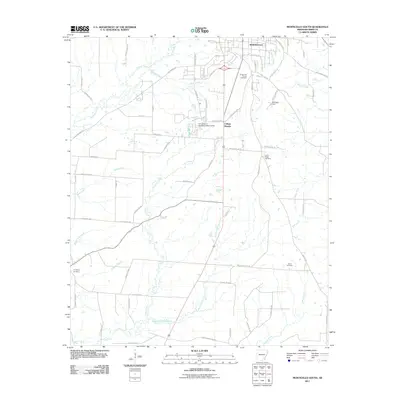
2011 Map of Monticello South
USGS Topo · Published 2011About this map
The University of Arkansas at Monticello anchors the northern portion of this landscape, just south of the main Monticello city limits. This area includes the community of College Heights and reflects a mix of institutional growth and rural residential development along the southern edge of the county seat. The terrain is defined by a dense network of waterways including Tenmile Creek, Wood Creek, and the winding South Fork Clear Creek, which suggests a history of difficult drainage and localized agriculture.
Find a feature on this map
73 named features on this map. Tap any name to fly to it.
Don’t see what you’re looking for? This feature index may not catch every label — zoom into the map to look around manually.
Map Details
Editions of this 2011 Monticello South Map
This is the sole edition of this map. No revisions or reprints were ever made.
Other maps of this area

1935 · Mist
USGS Topo · 1:62,500

1935 · Cominto
USGS Topo · 1:62,500

1953 · Greenwood
USGS Topo · 1:250,000

1956 · Greenwood
USGS Topo · 1:250,000

1960 · Mist
USGS Topo · 1:62,500

1960 · Collins NW
USGS Topo · 1:24,000

1960 · Collins
USGS Topo · 1:62,500

1960 · Cominto
USGS Topo · 1:24,000
1960 · Mist NW
USGS Topo · 1:24,000

1966 · Monticello North
USGS Topo · 1:24,000