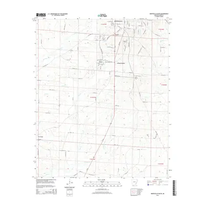
2014 Map of Monticello South
USGS Topo · Published 2014About this map
Monticello anchors the northern edge of this Drew County landscape, where the academic grounds of the Univ of Arkansas at Monticello and the community of College Heights form a distinct residential and institutional hub. The terrain to the south is defined by a dense network of drainage systems, including the meandering paths of Clear Creek and its South Fork, as well as Tenmile Creek and Wolf Creek. These waterways dictate the local geography, carving through the rural sections where small settlements like New Hope sit at the crossroads. Several burial grounds, such as the curiously named Rough and Ready Cemetery and the Union Ridge Cemetery, provide essential touchpoints for genealogical research. The map captures the area as it appeared in the early 21st century, showing the established road grid connecting these long-standing communities to the outlying agricultural and timber lands.
Find a feature on this map
98 named features on this map. Tap any name to fly to it.
Don’t see what you’re looking for? This feature index may not catch every label — zoom into the map to look around manually.
Map Details
Editions of this 2014 Monticello South Map
This is the sole edition of this map. No revisions or reprints were ever made.
Other maps of this area

1935 · Mist
USGS Topo · 1:62,500

1935 · Cominto
USGS Topo · 1:62,500

1953 · Greenwood
USGS Topo · 1:250,000

1956 · Greenwood
USGS Topo · 1:250,000

1960 · Mist
USGS Topo · 1:62,500

1960 · Collins NW
USGS Topo · 1:24,000

1960 · Collins
USGS Topo · 1:62,500

1960 · Cominto
USGS Topo · 1:24,000
1960 · Mist NW
USGS Topo · 1:24,000

1966 · Monticello North
USGS Topo · 1:24,000