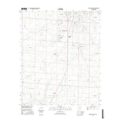
2017 Map of Monticello South
USGS Topo · Published 2017About this map
The Univ of Arkansas at Monticello serves as a northern anchor for this study of Drew County, where the transition from the city of Monticello to more rural landscapes is clearly defined. Just south of the university, the community of College Heights sits near the headwaters of Clear Creek, which winds southward through the center of the sheet. The landscape is marked by several traditional burial grounds including Rough and Ready Cem, Union Ridge Cem, and Baker Cem, each providing touchpoints for local family history and genealogical research. The drainage pattern is complex, with S Fork Clear Cr and Wolf Creek cutting through the terrain, while historic thoroughfares like Old Troy Rd and Seventh Day Camp Rd trace the paths of earlier regional transit before the modern highway era.
Find a feature on this map
87 named features on this map. Tap any name to fly to it.
Don’t see what you’re looking for? This feature index may not catch every label — zoom into the map to look around manually.
Map Details
Editions of this 2017 Monticello South Map
This is the sole edition of this map. No revisions or reprints were ever made.
Other maps of this area

1935 · Mist
USGS Topo · 1:62,500

1935 · Cominto
USGS Topo · 1:62,500

1953 · Greenwood
USGS Topo · 1:250,000

1956 · Greenwood
USGS Topo · 1:250,000

1960 · Mist
USGS Topo · 1:62,500

1960 · Collins NW
USGS Topo · 1:24,000

1960 · Collins
USGS Topo · 1:62,500

1960 · Cominto
USGS Topo · 1:24,000
1960 · Mist NW
USGS Topo · 1:24,000

1966 · Monticello North
USGS Topo · 1:24,000