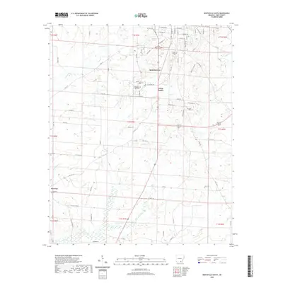
2020 Map of Monticello South
USGS Topo · Published 2020About this map
University of Arkansas at Monticello anchors the northern portion of this landscape, just south of the main streets of Monticello. The transition from the urban grid of S Main St and E College Ave into the residential area of College Heights gives way to a network of rural roads and creek drainages. Significant local history is preserved in the placement of small burial grounds like Rough and Ready Cem and Baker Cem, which sit alongside the tributaries of Clear Cr and Brown Cr.
Find a feature on this map
89 named features on this map. Tap any name to fly to it.
Don’t see what you’re looking for? This feature index may not catch every label — zoom into the map to look around manually.
Map Details
Editions of this 2020 Monticello South Map
This is the sole edition of this map. No revisions or reprints were ever made.
Other maps of this area

1935 · Mist
USGS Topo · 1:62,500

1935 · Cominto
USGS Topo · 1:62,500

1953 · Greenwood
USGS Topo · 1:250,000

1956 · Greenwood
USGS Topo · 1:250,000

1960 · Mist
USGS Topo · 1:62,500

1960 · Collins NW
USGS Topo · 1:24,000

1960 · Collins
USGS Topo · 1:62,500

1960 · Cominto
USGS Topo · 1:24,000
1960 · Mist NW
USGS Topo · 1:24,000

1966 · Monticello North
USGS Topo · 1:24,000