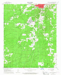
1966 Map of Monticello South
USGS Topo · Published 1967About this map
Arkansas A&M College anchors the central landscape of this Drew County survey, illustrating the educational expansion occurring in the mid-1960s south of Monticello. The map reveals a transition from the urbanized streets of the county seat to the rural drainages of Tenmile Creek and Clear Creek. The transportation corridor is defined by the Ashley Drew and Northern railroad, which runs north-south through the center of the sheet, connecting College Heights to the broader regional economy.
Find a feature on this map
39 named features on this map. Tap any name to fly to it.
Don’t see what you’re looking for? This feature index may not catch every label — zoom into the map to look around manually.
Map Details
Editions of this 1966 Monticello South Map
This is the sole edition of this map. No revisions or reprints were ever made.
Other maps of this area

1935 · Mist
USGS Topo · 1:62,500

1935 · Cominto
USGS Topo · 1:62,500

1953 · Greenwood
USGS Topo · 1:250,000

1956 · Greenwood
USGS Topo · 1:250,000

1960 · Mist
USGS Topo · 1:62,500

1960 · Collins NW
USGS Topo · 1:24,000

1960 · Collins
USGS Topo · 1:62,500

1960 · Cominto
USGS Topo · 1:24,000
1960 · Mist NW
USGS Topo · 1:24,000

1966 · Monticello North
USGS Topo · 1:24,000