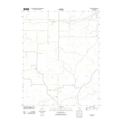
2011 Map of Montier
USGS Topo · Published 2011About this map
Montier serves as the primary settlement hub in this part of Shannon County, situated along the corridor defined by Old Hwy 60. The landscape is defined by the winding paths of Spring Creek and Birch Creek, which carve through the terrain near the prominent elevation of High Hill. This 2011 survey captures the rural character of the region, where the road network is a mixture of established routes and numerous county roads like Co Road T-A and Co Road MM-661. Genealogists and local historians will find several key burial sites documented, including New Salem Cemetery, Bethlehem Cemetery, and Brown Cemetery. The settlement of Not appears further south, illustrating the small, localized communities that persist in this area of the Ozarks. The map reflects a quiet, enduring rural geography where land use is dictated by the watercourses and the historical path of the regional highway system.
Find a feature on this map
36 named features on this map. Tap any name to fly to it.
Don’t see what you’re looking for? This feature index may not catch every label — zoom into the map to look around manually.
Map Details
Editions of this 2011 Montier Map
This is the sole edition of this map. No revisions or reprints were ever made.
Other maps of this area

1915 · Eminence
USGS Topo · 1:62,500

1917 · Eminence
USGS Topo · 1:62,500

1931 · Bandyville
USGS Topo · 1:48,000

1944 · Birch Tree
USGS Topo · 1:62,500

1945 · Montier
USGS Topo · 1:62,500

1946 · Summersville
USGS Topo · 1:62,500

1948 · Montier
USGS Topo · 1:62,500

1948 · Birch Tree
USGS Topo · 1:62,500

1948 · Summersville
USGS Topo · 1:62,500

1949 · Rolla
USGS Topo · 1:250,000