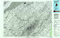
1993 Map of Montmagny
USGS Topo · Published 1994About this map
The Fleuve Saint-Laurent dominates the northwestern edge of this binational region, where the broad river is divided by the Chenal du Nord and Chenal du Sud around the tip of Île d'Orléans. This 1993 compilation by the U.S. Geological Survey and the Department of Energy, Mines and Resources Canada highlights the complex geography of the international border. In Quebec, a series of established settlements including Montmagny, Saint-Pierre-Montmagny, and Saint-Vallier line the coastal corridor. Moving southeast, the terrain rises into the Monts Notre-Dame, a rugged upland that crosses into the wooded interior of Maine. Within this remote boundary zone, significant water bodies like Lac de l'Est and Lac Frontière serve as central landmarks for the sparsely populated reaches of Somerset Co and Aroostook Co. The map illustrates the contrast between the dense river-fronting parishes of the Saint Lawrence valley and the vast timberlands of northern Maine.
Find a feature on this map
19 named features on this map. Tap any name to fly to it.
Don’t see what you’re looking for? This feature index may not catch every label — zoom into the map to look around manually.
Map Details
Editions of this 1993 Montmagny Map
This is the sole edition of this map. No revisions or reprints were ever made.
Other maps of this area

1954 · Baker Lake
USGS Topo · 1:62,500

1954 · Presque Isle
USGS Topo · 1:250,000

1955 · Depot Lake
USGS Topo · 1:62,500

1955 · Beaver Pond
USGS Topo · 1:62,500

1957 · Hardwood Mountain
USGS Topo · 1:62,500

1958 · Presque Isle
USGS Topo · 1:250,000

1960 · Presque Isle
USGS Topo · 1:250,000

1962 · Baker Lake
USGS Topo · 1:62,500

1962 · Edmundston
USGS Topo · 1:250,000

1962 · Quebec
USGS Topo · 1:250,000