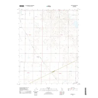
2018 Map of Montpelier
USGS Topo · Published 2018About this map
Montpelier sits at the heart of this agricultural landscape within the San Joaquin Valley, where a network of straight-line roads and irrigation systems defines the rural character of eastern Stanislaus County. The Turlock Main Canal cuts across the northwest corner, a vital piece of water infrastructure that supports the surrounding farmsteads and orchards. This part of the Central Valley is characterized by its organized grid of thoroughfares, including Montpelier Rd, E Keyes Rd, and E Monte Vista Ave. The transition between Stanislaus and Merced counties is marked by a diagonal boundary line that cuts through the southern sections of the survey, where Oakdale Rd and Looney Rd provide local access to the sprawling agricultural tracts.
Find a feature on this map
31 named features on this map. Tap any name to fly to it.
Don’t see what you’re looking for? This feature index may not catch every label — zoom into the map to look around manually.
Map Details
Editions of this 2018 Montpelier Map
This is the sole edition of this map. No revisions or reprints were ever made.
Other maps of this area

1913 · Dickenson
USGS Topo · 1:31,680

1915 · Paulsell
USGS Topo · 1:31,680

1916 · Three Tree Flat
USGS Topo · 1:31,680

1916 · Cressey
USGS Topo · 1:31,680

1916 · Montpellier
USGS Topo · 1:31,680

1916 · Cooperstown
USGS Topo · 1:31,680

1916 · Denair
USGS Topo · 1:31,680

1916 · Waterford
USGS Topo · 1:31,680

1917 · Turlock
USGS Topo · 1:31,680

1917 · Winton
USGS Topo · 1:31,680