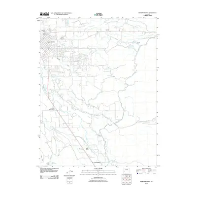
2010 Map of Montrose East
USGS Topo · Published 2010About this map
The Uncompahgre River defines the western edge of this landscape, its waters diverted through an intricate network of irrigation systems including the Montrose and Delta Canal and the Loutsenhizer Canal. This complex engineering of the arid Colorado high desert is further detailed by numerous smaller branches like the A M Lateral and South Canal, which support agriculture around the developing fringes of Montrose. Local history is anchored by several burial grounds, from Cedar Cemetery in the north to the Button Cemetery further south, and the Uncompahgre Memorial Gardens near the river. Beyond the residential grid, the map shows industrial and recreational sites such as the Corey Gravel Pit and the Montrose Golf Course, alongside rural landmarks like Woods Stolport and the settlements of Fairview and Vernal.
Find a feature on this map
56 named features on this map. Tap any name to fly to it.
Don’t see what you’re looking for? This feature index may not catch every label — zoom into the map to look around manually.
Map Details
Editions of this 2010 Montrose East Map
This is the sole edition of this map. No revisions or reprints were ever made.
Other maps of this area

1909 · Montrose
USGS Topo · 1:125,000

1911 · Montrose
USGS Topo · 1:125,000

1955 · Olathe
USGS Topo · 1:24,000

1955 · Red Rock Canyon
USGS Topo · 1:24,000

1956 · Montrose
USGS Topo · 1:250,000

1957 · Cerro Summit
USGS Topo · 1:24,000

1957 · Grizzly Ridge
USGS Topo · 1:24,000

1959 · Montrose
USGS Topo · 1:250,000

1960 · Montrose
USGS Topo · 1:250,000
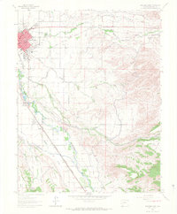
1962 · Montrose East
USGS Topo · 1:24,000