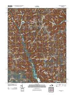
2011 Map of Montross
USGS Topo · Published 2011About this map
Montross and its surrounding hamlets in Westmoreland County are defined by a complex network of wetlands and tidal inlets. The landscape is characterized by numerous swamps including Kenna Swamp, Black Swamp, and Nanny Sanford Swamp, which feed into major watercourses like Cat Point Creek. This survey highlights the region's agricultural and milling roots, evidenced by features such as Chandlers Millpond and Weavers Millpond. Small rural settlements like Zacata, Nomini Grove, and Templeman anchor the road network, while family-named landmarks like Porters Meadow and Meadow Farm suggest long-standing land ownership patterns. Significant for genealogists, the map identifies several burial grounds including Welcome Grove Cemetery and Menokin Cemetery, alongside localized place names such as Tallent Town and Germans Corner. The southern portion of the quadrangle descends toward the water at Menokin Bay and Menokin Landing, marking the transition from the high ground of Stony Hill to the marshes.
Find a feature on this map
82 named features on this map. Tap any name to fly to it.
Don’t see what you’re looking for? This feature index may not catch every label — zoom into the map to look around manually.
Map Details
Editions of this 2011 Montross Map
This is the sole edition of this map. No revisions or reprints were ever made.
Other maps of this area

1892 · Piney Point
USGS Topo · 1:62,500

1892 · Montross
USGS Topo · 1:62,500

1894 · Piney Point
USGS Topo · 1:62,500

1895 · Nomini
USGS Topo · 1:125,000

1895 · Piney Point
USGS Topo · 1:62,500

1895 · Montross
USGS Topo · 1:62,500

1898 · Nomini
USGS Topo · 1:125,000

1901 · Piney Point
USGS Topo · 1:62,500

1917 · Morattico
USGS Topo · 1:62,500

1918 · Tappahannock
USGS Topo · 1:62,500