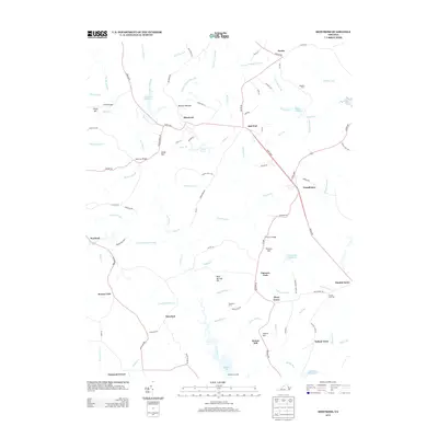
2013 Map of Montross
USGS Topo · Published 2013About this map
Montross serves as the focal point of this Northern Neck landscape, where the intersection of Kings Hwy and several local routes anchors the surrounding agricultural and marshy terrain. The region is defined by an intricate network of waterways and lowlands, such as Black Swamp, Poorhouse Swamp, and Nanny Sanford Swamp, which drain into larger creek systems. These hydrological patterns shaped early settlement and industry, evidenced by landmarks like Weavers Millpond and Chandlers Millpond. Near the southern boundary, Menokin Landing provides a connection to the water, reflecting the area's long-standing reliance on riverine access.
Find a feature on this map
111 named features on this map. Tap any name to fly to it.
Don’t see what you’re looking for? This feature index may not catch every label — zoom into the map to look around manually.
Map Details
Editions of this 2013 Montross Map
This is the sole edition of this map. No revisions or reprints were ever made.
Other maps of this area

1892 · Piney Point
USGS Topo · 1:62,500

1892 · Montross
USGS Topo · 1:62,500

1894 · Piney Point
USGS Topo · 1:62,500

1895 · Nomini
USGS Topo · 1:125,000

1895 · Piney Point
USGS Topo · 1:62,500

1895 · Montross
USGS Topo · 1:62,500

1898 · Nomini
USGS Topo · 1:125,000

1901 · Piney Point
USGS Topo · 1:62,500

1917 · Morattico
USGS Topo · 1:62,500

1918 · Tappahannock
USGS Topo · 1:62,500