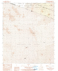
1990 Map of Monument Bluff
USGS Topo · Published 1991About this map
The international boundary between the United States of America and Estados Unidos Mexicanos cuts diagonally across this arid landscape, dividing the Cabeza Prieta Wilderness in Arizona from the vast Desierto de Altar in Sonora. This 1990 provisional survey documents a transition zone where the Barry M Goldwater Air Force Range meets the volcanic features of the Pinacate Valley. The terrain is defined by shifting sands and isolated peaks, such as Monument Bluff and Cerro La Silla. On the Mexican side, the settlement of Guadalupe Victoria and the Cerro La Lava Microondas station sit south of the historic Camino Del Diablo trail, while the Pinta Sands and Tule Desert stretch across the border, illustrating the shared geography of this transborder region.
Find a feature on this map
21 named features on this map. Tap any name to fly to it.
Don’t see what you’re looking for? This feature index may not catch every label — zoom into the map to look around manually.
Map Details
Editions of this 1990 Monument Bluff Map
This is the sole edition of this map. No revisions or reprints were ever made.
Other maps of this area

1953 · Ajo
USGS Topo · 1:250,000

1954 · Sonoyta
USGS Topo · 1:250,000

1957 · Ajo
USGS Topo · 1:250,000

1958 · Ajo
USGS Topo · 1:250,000

1962 · Ajo
USGS Topo · 1:250,000

1963 · Ajo
USGS Topo · 1:250,000

1963 · Lukeville
USGS Topo · 1:250,000

1965 · O'Neill Hills
USGS Topo · 1:62,500

1965 · Sierra Arida
USGS Topo · 1:62,500

1967 · Ajo
USGS Topo · 1:250,000