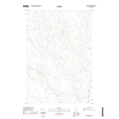
2021 Map of Monument Brook
USGS Topo · Published 2021About this map
The East Branch Mattawamkeag River and West Branch Mattawamkeag River converge in this northern Maine landscape, defining a complex network of wetlands and drainage basins. This modern survey illustrates how water dominates the geography, with tributaries like Skitacook Stream and Monument Brook threading through a region primarily accessible via a network of rural routes and gravel tracks. The presence of Dow Farm Rd suggests the historical agricultural footprint in a territory otherwise characterized by extensive forest and bog.
Find a feature on this map
16 named features on this map. Tap any name to fly to it.
Don’t see what you’re looking for? This feature index may not catch every label — zoom into the map to look around manually.
Map Details
Editions of this 2021 Monument Brook Map
This is the sole edition of this map. No revisions or reprints were ever made.
Other maps of this area

1937 · Smyrna Mills
USGS Topo · 1:62,500

1938 · Houlton
USGS Topo · 1:62,500

1940 · Amity
USGS Topo · 1:62,500

1941 · Amity
USGS Topo · 1:62,500

1941 · Mattawamkeag Lake
USGS Topo · 1:62,500

1943 · Amity
USGS Topo · 1:62,500

1943 · Mattawamkeag Lake
USGS Topo · 1:62,500

1951 · Houlton
USGS Topo · 1:62,500

1954 · Presque Isle
USGS Topo · 1:250,000

1954 · Millinocket
USGS Topo · 1:250,000