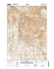
2014 Map of Monument Peak
USGS Topo · Published 2014About this map
Monument Peak and the high plateaus of Malheur County define this arid landscape, where water management is the primary marker of human activity. The map reveals an extensive system of small-scale water engineering, featuring numerous impoundments such as Dinner Creek Reservoir Number One, Camp Creek Reservoir, and the series of four Prava Peak Reservoirs. These features, alongside Wildhorse Spring and Twin Tank Spring, illustrate the critical importance of water storage for ranching and land use in eastern Oregon. Notable terrain features like School Section Table and Deacon Flat suggest a landscape used for seasonal grazing, connected by rugged routes like Shumway Rd and Peak Rd. The presence of School Section Reservoir indicates the historical allocation of state lands for educational funding, a common pattern in Western land distribution.
Find a feature on this map
54 named features on this map. Tap any name to fly to it.
Don’t see what you’re looking for? This feature index may not catch every label — zoom into the map to look around manually.
Map Details
Editions of this 2014 Monument Peak Map
This is the sole edition of this map. No revisions or reprints were ever made.
Other maps of this area

1955 · Burns
USGS Topo · 1:250,000

1955 · Boise
USGS Topo · 1:250,000

1958 · Burns
USGS Topo · 1:250,000

1958 · Boise
USGS Topo · 1:250,000

1959 · Burns
USGS Topo · 1:250,000

1962 · Boise
USGS Topo · 1:250,000

1966 · Westfall Butte
USGS Topo · 1:62,500

1966 · Beulah
USGS Topo · 1:62,500

1972 · Tims Peak
USGS Topo · 1:24,000

1972 · Shumway Reservoir
USGS Topo · 1:24,000