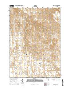
2017 Map of Monument Peak
USGS Topo · Published 2017About this map
Monument Peak and Prava Peak anchor this high-elevation landscape in eastern Oregon, where water management is the primary signature of land use. The terrain is defined by a dense network of small-scale water improvements, including Nanny Reservoir, Pinhead Reservoir, and a numbered series of impoundments such as Prava Peak Reservoir Number One and Dinner Cr Reservoir Number Three. These features, alongside Wildhorse Spring, trace the critical infrastructure of ranching and resource management across Wildhorse Basin and Deacon Flat.
Find a feature on this map
53 named features on this map. Tap any name to fly to it.
Don’t see what you’re looking for? This feature index may not catch every label — zoom into the map to look around manually.
Map Details
Editions of this 2017 Monument Peak Map
This is the sole edition of this map. No revisions or reprints were ever made.
Other maps of this area

1955 · Burns
USGS Topo · 1:250,000

1955 · Boise
USGS Topo · 1:250,000

1958 · Burns
USGS Topo · 1:250,000

1958 · Boise
USGS Topo · 1:250,000

1959 · Burns
USGS Topo · 1:250,000

1962 · Boise
USGS Topo · 1:250,000

1966 · Westfall Butte
USGS Topo · 1:62,500

1966 · Beulah
USGS Topo · 1:62,500

1972 · Tims Peak
USGS Topo · 1:24,000

1972 · Shumway Reservoir
USGS Topo · 1:24,000