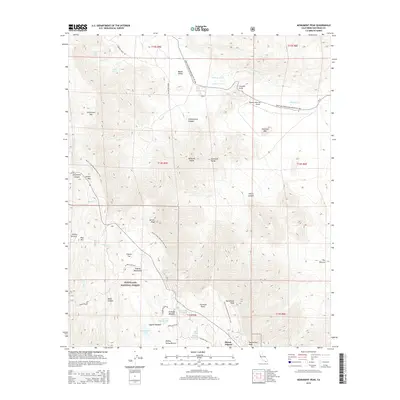
2015 Map of Monument Peak
USGS Topo · Published 2015About this map
The Great Southern Overland Rte of 1849 cuts through the desert floor here, following the path of the historic Butterfield Overland Mail through Mason Valley and Vallecito Valley. This corridor, a vital thoroughfare during the mid-19th-century westward expansion, sits in sharp contrast to the high-elevation terrain of the Laguna Mountains to the south. Within the Cleveland National Forest, the landscape rises toward Monument Peak and Mount Laguna, where the Pacific Crest National Scenic Trail winds along the rim of Storm Canyon. This survey captures the transition from arid valley washes like Vallecito Wash to the montane environments surrounding Big Laguna Lake and Little Laguna Lake. The presence of the Rancho Vallecito Airport and various reservoirs, including Chula Vista Reservoir, highlights the modern management of water and transit in this remote corner of San Diego County.
Find a feature on this map
55 named features on this map. Tap any name to fly to it.
Don’t see what you’re looking for? This feature index may not catch every label — zoom into the map to look around manually.
Map Details
Editions of this 2015 Monument Peak Map
This is the sole edition of this map. No revisions or reprints were ever made.
Other maps of this area

1903 · Cuyamaca
USGS Topo · 1:125,000

1903 · Ramona
USGS Topo · 1:125,000

1904 · Southern California Sheet No. 2
USGS Topo · 1:250,000

1931 · Vallecito
USGS Topo · 1:125,000

1931 · Carrizo
USGS Topo · 1:125,000

1939 · Santa Ysabel
USGS Topo · 1:62,500

1939 · Borrego
USGS Topo · 1:62,500

1942 · Borego
USGS Topo · 1:62,500

1942 · Cuyapaipe
USGS Topo · 1:62,500

1942 · Cuyamaca Peak
USGS Topo · 1:62,500