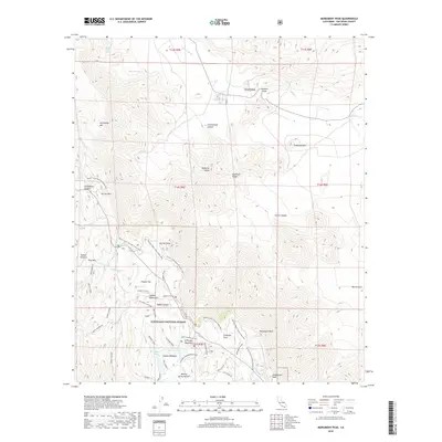
2018 Map of Monument Peak
USGS Topo · Published 2018About this map
Mason Valley and the Sawtooth Range anchor this high-elevation landscape in eastern San Diego County, where the transition between arid washes and mountainous forests is sharply defined. The terrain is marked by significant topographic features like Monument Peak and Stephenson Peak, rising above the interior valleys. Within the Cleveland National Forest, the Pacific Crest National Scenic Trail winds along the ridgelines of the Laguna Mountains, offering views into the deep recesses of Storm Canyon and Oriflamme Canyon. High mountain meadows and hydrology define the southern portion of the sheet, where Big Laguna Lake, Little Laguna Lake, and El Prado Meadow provide rare water sources. Historical travel routes are indicated by the Campbell Grade and several forest service roads such as Los Huecos Rd, illustrating the remote connectivity of this wilderness area.
Find a feature on this map
48 named features on this map. Tap any name to fly to it.
Don’t see what you’re looking for? This feature index may not catch every label — zoom into the map to look around manually.
Map Details
Editions of this 2018 Monument Peak Map
This is the sole edition of this map. No revisions or reprints were ever made.
Other maps of this area

1903 · Cuyamaca
USGS Topo · 1:125,000

1903 · Ramona
USGS Topo · 1:125,000

1904 · Southern California Sheet No. 2
USGS Topo · 1:250,000

1931 · Vallecito
USGS Topo · 1:125,000

1931 · Carrizo
USGS Topo · 1:125,000

1939 · Santa Ysabel
USGS Topo · 1:62,500

1939 · Borrego
USGS Topo · 1:62,500

1942 · Borego
USGS Topo · 1:62,500

1942 · Cuyapaipe
USGS Topo · 1:62,500

1942 · Cuyamaca Peak
USGS Topo · 1:62,500