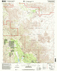
1997 Map of Monument Peak
USGS Topo · Published 2000About this map
Cleveland National Forest and the Anza-Borrego Desert State Park meet in this landscape of high meadows and arid canyons. The map documents the transition from the pine-crested heights of Mount Laguna to the low expanse of Mason Valley, illustrating the region's long history as a transit corridor. Historical travel is preserved through the Overland Stage Route and the Pioneer Mail Highway, tracing the path of early settlers and mail carriers across the Campbell Grade.
Find a feature on this map
76 named features on this map. Tap any name to fly to it.
Don’t see what you’re looking for? This feature index may not catch every label — zoom into the map to look around manually.
Map Details
Editions of this 1997 Monument Peak Map
This is the sole edition of this map. No revisions or reprints were ever made.
Other maps of this area

1903 · Cuyamaca
USGS Topo · 1:125,000

1903 · Ramona
USGS Topo · 1:125,000

1904 · Southern California Sheet No. 2
USGS Topo · 1:250,000

1931 · Vallecito
USGS Topo · 1:125,000

1931 · Carrizo
USGS Topo · 1:125,000

1939 · Santa Ysabel
USGS Topo · 1:62,500

1939 · Borrego
USGS Topo · 1:62,500

1942 · Borego
USGS Topo · 1:62,500

1942 · Cuyapaipe
USGS Topo · 1:62,500

1942 · Cuyamaca Peak
USGS Topo · 1:62,500