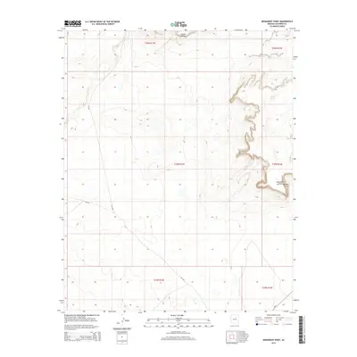
2014 Map of Monument Point
USGS Topo · Published 2014About this map
Garces Mesas and the high promontory of Monument Point define this Coconino County landscape, where the high desert terrain is marked by intricate contour work and isolated water sources. This 2014 survey captures a section of the Navajo Nation dominated by dramatic elevation changes along the eastern edge of the quadrangle. The map documents essential infrastructure for this arid region, including Hiway Tank and a network of Bureau of Indian Affairs routes such as Bia-6730, Bia-6721, and Bia-6720. These roads represent the primary corridors through the township and range system, providing access to the mesa tops and canyon edges that characterize the local geography.
Find a feature on this map
13 named features on this map. Tap any name to fly to it.
Don’t see what you’re looking for? This feature index may not catch every label — zoom into the map to look around manually.
Map Details
Editions of this 2014 Monument Point Map
This is the sole edition of this map. No revisions or reprints were ever made.
Other maps of this area

1883 · Tusayan
USGS Topo · 1:250,000

1886 · Tusayan
USGS Topo · 1:250,000

1886 · San Francisco Mtns
USGS Topo · 1:250,000

1891 · San Francisco Mtns
USGS Topo · 1:250,000

1894 · San Francisco Mtns
USGS Topo · 1:250,000

1899 · San Francisco Mtns
USGS Topo · 1:250,000

1947 · Flagstaff
USGS Topo · 1:250,000

1954 · Flagstaff
USGS Topo · 1:250,000

1955 · Grand Falls NE
USGS Topo · 1:24,000
1955 · Black Falls 4 SE
USGS Topo · 1:24,000