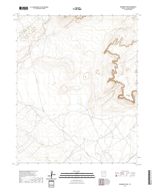
2021 Map of Monument Point
USGS Topo · Published 2021About this map
Garces Mesas dominates the northern horizon of this high-altitude landscape in Coconino County, where the topography transitions into the dramatic escarpments of the Monument Point region. The 2021 survey illustrates a sparse but critical infrastructure network centered on Indian Rte 6720, which winds through the central plateau. This area is characterized by vast open spaces and sharp geographical transitions, particularly near the jagged edges of the Kachina Points to the east. These named landmarks serve as essential navigational markers in a territory defined by complex township and range boundaries. The presence of Indian Rte 6730 and Indian Rte 2 further indicates the primary corridors for movement across this traditional landscape, providing a modern record of land use and accessibility in this part of Arizona.
Find a feature on this map
14 named features on this map. Tap any name to fly to it.
Don’t see what you’re looking for? This feature index may not catch every label — zoom into the map to look around manually.
Map Details
Editions of this 2021 Monument Point Map
This is the sole edition of this map. No revisions or reprints were ever made.
Other maps of this area

1883 · Tusayan
USGS Topo · 1:250,000

1886 · Tusayan
USGS Topo · 1:250,000

1886 · San Francisco Mtns
USGS Topo · 1:250,000

1891 · San Francisco Mtns
USGS Topo · 1:250,000

1894 · San Francisco Mtns
USGS Topo · 1:250,000

1899 · San Francisco Mtns
USGS Topo · 1:250,000

1947 · Flagstaff
USGS Topo · 1:250,000

1954 · Flagstaff
USGS Topo · 1:250,000

1955 · Grand Falls NE
USGS Topo · 1:24,000
1955 · Black Falls 4 SE
USGS Topo · 1:24,000