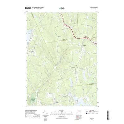
2018 Map of Moodus
USGS Topo · Published 2018About this map
The Salmon River carves a deep valley through the center of this southeastern Connecticut landscape, acting as a historical boundary for the settlements of Leesville, Westchester, and Moodus. The topography is defined by significant ridges and water bodies, with the Moodus Reservoir and Moodus River anchoring the southern portion of the sheet. Notable landmarks like the Old Comstock Bridge span the river, while the presence of numerous burying grounds, such as Saint Bridgets Cem and Ponemah Cem, point to the area’s long-standing community centers. To the west, the village of East Hampton sits near the edge of Pocotopaug Lake, while the Silvio O Conte National Fish and Wildlife Refuge preserves the riverine environment near Cave Hill. The intersection of multiple county lines including Hartford, Tolland, New London, and Middlesex highlights the region's complex administrative history.
Find a feature on this map
175 named features on this map. Tap any name to fly to it.
Don’t see what you’re looking for? This feature index may not catch every label — zoom into the map to look around manually.
Map Details
Editions of this 2018 Moodus Map
This is the sole edition of this map. No revisions or reprints were ever made.
Other maps of this area

1892 · Gilead
USGS Topo · 1:62,500

1893 · Guilford
USGS Topo · 1:62,500

1893 · Middletown
USGS Topo · 1:62,500

1893 · Saybrook
USGS Topo · 1:62,500

1906 · Farmington
USGS Topo · 1:125,000

1928 · Glastonbury
USGS Topo · 1:24,000

1944 · Marlboro
USGS Topo · 1:31,680

1944 · Columbia
USGS Topo · 1:31,680

1944 · Deep River
USGS Topo · 1:31,680

1945 · Middle Haddam
USGS Topo · 1:31,680