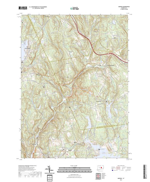
2024 Map of Moodus
USGS Topo · Published 2024About this map
Moodus and the surrounding Connecticut river valleys are defined by a complex network of waterways and early manufacturing settlements. The Salmon River flows through the heart of this landscape, joined by tributaries like Jeremy River and Moodus River, which historically provided the water power for the area's legendary milling industry. To the west, the recreation and residential hub around Lake Pocotopaug near East Hampton contrasts with the protected lands of the Silvio O Conte National Fish and Wildlife Refuge. Significant genealogical interest is found in the numerous burying grounds scattered across the townships, including the Congregation Rodfe Zedek Cem and the Saint Bridgets Cem. The presence of the Salmon River Trl indicates the repurposing of former rail corridors into modern recreational paths, while small airfields like Salmon River Airfield reflect the region's mid-century development patterns.
Find a feature on this map
167 named features on this map. Tap any name to fly to it.
Don’t see what you’re looking for? This feature index may not catch every label — zoom into the map to look around manually.
Map Details
Editions of this 2024 Moodus Map
This is the sole edition of this map. No revisions or reprints were ever made.
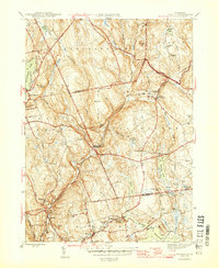
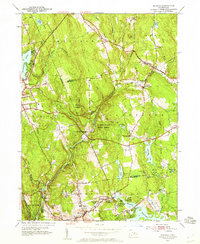
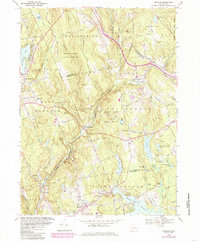
Historical Maps of East Hampton Through Time
4 maps found