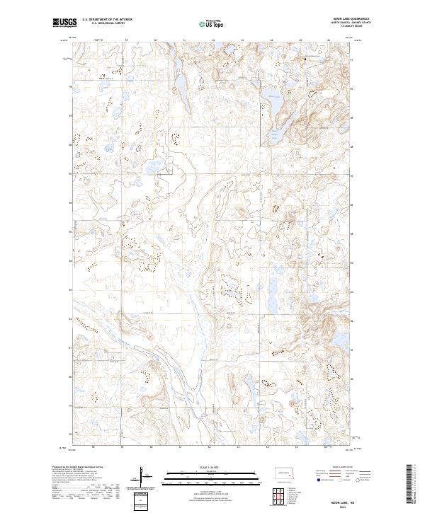
2024 Map of Moon Lake
USGS Topo · Published 2024About this map
Moon Lake and the adjacent Saint Marys Lake anchor this glaciated prairie landscape in central North Dakota, where the terrain is defined by numerous small depressions and wetlands. The upland areas are managed in part as the Barnes County Waterfowl Production Area, reflecting the importance of this region to migratory birds and conservation efforts. The map reveals a strict rectangular section-line road grid, with Co Hwy 11 providing a primary north-south corridor through the rolling plains.
Find a feature on this map
21 named features on this map. Tap any name to fly to it.
Don’t see what you’re looking for? This feature index may not catch every label — zoom into the map to look around manually.
Map Details
Editions of this 2024 Moon Lake Map
This is the sole edition of this map. No revisions or reprints were ever made.
Other maps of this area

1897 · Eckelson
USGS Topo · 1:125,000

1953 · Jamestown
USGS Topo · 1:250,000

1956 · Jamestown
USGS Topo · 1:250,000

1961 · Valley City West
USGS Topo · 1:24,000

1970 · Litchville
USGS Topo · 1:24,000
1970 · Hastings
USGS Topo · 1:24,000

1970 · Eckelson
USGS Topo · 1:24,000
1970 · Moon Lake
USGS Topo · 1:24,000

1970 · Marion NE
USGS Topo · 1:24,000
1970 · Sanborn SE
USGS Topo · 1:24,000