
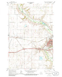
1961 Map of Valley City West
USGS Topo · Published 1963About this map
The Sheyenne River meanders sharply through the eastern portion of this quadrangle, defining the physical and economic geography of Valley City in the early 1960s. This settlement serves as a significant regional hub, anchored by the State Teachers College, a Hospital, and the Northern Pacific railroad lines that bisect the town. The presence of the National Fish Hatchery and Pioneer Park along the riverbanks highlights the integration of conservation and civic space during this era.
Find a feature on this map
37 named features on this map. Tap any name to fly to it.
Don’t see what you’re looking for? This feature index may not catch every label — zoom into the map to look around manually.
Map Details
Editions of this 1961 Valley City West Map
2 editions found
Other maps of this area

1897 · Tower
USGS Topo · 1:125,000

1897 · Eckelson
USGS Topo · 1:125,000

1952 · Grand Forks
USGS Topo · 1:250,000

1952 · New Rockford
USGS Topo · 1:250,000

1953 · Jamestown
USGS Topo · 1:250,000

1953 · Fargo
USGS Topo · 1:250,000

1956 · New Rockford
USGS Topo · 1:250,000

1956 · Fargo
USGS Topo · 1:250,000

1956 · Jamestown
USGS Topo · 1:250,000

1956 · Grand Forks
USGS Topo · 1:250,000