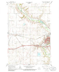
1961 Map of Valley City West
USGS Topo · Published 1986About this map
The Sheyenne River winds through the heart of this North Dakota landscape, serving as the backdrop for the regional growth of Valley City during the early 1960s. The town is depicted as a bustling hub of education and transport, anchored by the State Teachers College and the intersection of the Northern Pacific and Soo Line railroads. This era marks the transition to modern infrastructure, evidenced by the construction of Interstate 94 and its major interchanges, including the West Valley City Interchange.
Find a feature on this map
35 named features on this map. Tap any name to fly to it.
Don’t see what you’re looking for? This feature index may not catch every label — zoom into the map to look around manually.
Map Details
Editions of this 1961 Valley City West Map
2 editions found

Other maps of this area

1897 · Tower
USGS Topo · 1:125,000

1897 · Eckelson
USGS Topo · 1:125,000

1952 · Grand Forks
USGS Topo · 1:250,000

1952 · New Rockford
USGS Topo · 1:250,000

1953 · Jamestown
USGS Topo · 1:250,000

1953 · Fargo
USGS Topo · 1:250,000

1956 · New Rockford
USGS Topo · 1:250,000

1956 · Fargo
USGS Topo · 1:250,000

1956 · Jamestown
USGS Topo · 1:250,000

1956 · Grand Forks
USGS Topo · 1:250,000