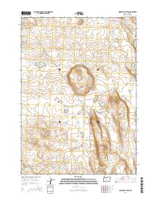
2014 Map of Moonlight Butte
USGS Topo · Published 2014About this map
Moonlight Butte rises as a central landmark in this high-desert landscape of Lake County, where ephemeral water sources and remote tracks define the geography. The map reveals a cluster of seasonal basins, including Bull Lake, Chicago Pond, and Benjamin Lk, which indicate the importance of water management in this arid territory. This 2014 survey captures a network of primitive access routes such as Fredrick Butte road and Wardell, cutting through the vast desert flats. A significant geological or botanical interest is suggested by the presence of Lost Forest Ln in the southern portion of the quadrangle, while the land is organized by the Public Land Survey System grids of t24s r20e and t25s r20e. The eastern edge is defined by the topographic transition into Browns Valley, providing a detailed view of the drainage patterns and land contours of the Oregon interior.
Find a feature on this map
14 named features on this map. Tap any name to fly to it.
Don’t see what you’re looking for? This feature index may not catch every label — zoom into the map to look around manually.
Map Details
Editions of this 2014 Moonlight Butte Map
This is the sole edition of this map. No revisions or reprints were ever made.
Other maps of this area

1955 · Crescent
USGS Topo · 1:250,000

1957 · Crescent
USGS Topo · 1:250,000

1958 · Crescent
USGS Topo · 1:250,000

1970 · Crescent
USGS Topo · 1:250,000

1981 · Fossil Lake
USGS Topo · 1:24,000

1981 · Sand Rock
USGS Topo · 1:24,000

1981 · Moonlight Butte
USGS Topo · 1:24,000

1981 · Mean Rock Well
USGS Topo · 1:24,000

1981 · Elk Butte
USGS Topo · 1:24,000

1981 · Chicago Valley
USGS Topo · 1:24,000