
1981 Map of Fossil Lake
USGS Topo · Published 1981About this map
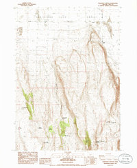
Christmas Lake Valley defines the expansive desert geography of this high-desert region, where survival in the early 20th century depended on critical water sources like Mound Spring and Wardell Well. The map identifies the former community of Cliff (Site), a dry-land farming settlement that once served local homesteaders before the harsh environment led to its decline. To the north, the terrain shifts into the dunes of Sucker Flat and the protected Lost Forest Research Natural Area, an isolated stand of ponderosa pine surviving far from its typical range. This 1981 survey documents a landscape of dramatic geological features, from the dry basin of Fossil Lake to the vast Buffalo Flat, where remote 4WD tracks represent the primary infrastructure for traversing the arid flats and shifting sands.
Find a feature on this map
14 named features on this map. Tap any name to fly to it.
Don’t see what you’re looking for? This feature index may not catch every label — zoom into the map to look around manually.
Map Details
Editions of this 1981 Fossil Lake Map
This is the sole edition of this map. No revisions or reprints were ever made.
Other maps of this area

1955 · Crescent
USGS Topo · 1:250,000

1957 · Crescent
USGS Topo · 1:250,000

1958 · Crescent
USGS Topo · 1:250,000

1970 · Crescent
USGS Topo · 1:250,000

1981 · Sand Rock
USGS Topo · 1:24,000

1981 · Moonlight Butte
USGS Topo · 1:24,000

1981 · Mean Rock Well
USGS Topo · 1:24,000

1982 · Peters Creek Sink
USGS Topo · 1:24,000

1982 · Christmas Lake
USGS Topo · 1:24,000
1986 · Fandango Canyon
USGS Topo · 1:24,000