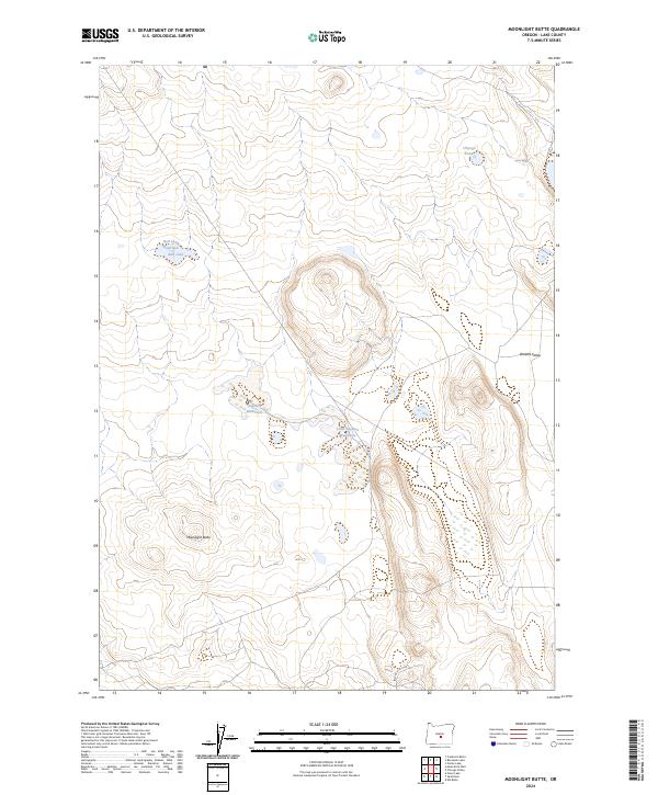
2024 Map of Moonlight Butte
USGS Topo · Published 2024About this map
Moonlight Butte rises as a prominent landmark in this high-desert region of Lake County, where water resources define the utility and character of the land. The landscape is marked by a network of seasonal catchments and depressions critical for livestock and wildlife, including Bull Lake, the nearby Bull Lake Waterhole, and the specialized drainage of Browns Valley to the east. These intermittent water sources, along with Chicago Pond and the Sagehen Waterhole, reflect the arid nature of the basin-and-range terrain. The presence of the BLM Rd 6151-0-00 suggests the ongoing management of public lands by the Bureau of Land Management, providing the primary access through this sparsely developed territory of Oregon's high desert country.
Find a feature on this map
12 named features on this map. Tap any name to fly to it.
Don’t see what you’re looking for? This feature index may not catch every label — zoom into the map to look around manually.
Map Details
Editions of this 2024 Moonlight Butte Map
This is the sole edition of this map. No revisions or reprints were ever made.
Other maps of this area

1955 · Crescent
USGS Topo · 1:250,000

1957 · Crescent
USGS Topo · 1:250,000

1958 · Crescent
USGS Topo · 1:250,000

1970 · Crescent
USGS Topo · 1:250,000

1981 · Fossil Lake
USGS Topo · 1:24,000

1981 · Sand Rock
USGS Topo · 1:24,000

1981 · Moonlight Butte
USGS Topo · 1:24,000

1981 · Mean Rock Well
USGS Topo · 1:24,000

1981 · Elk Butte
USGS Topo · 1:24,000

1981 · Chicago Valley
USGS Topo · 1:24,000