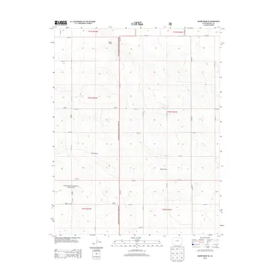
2013 Map of Moore Draw SE
USGS Topo · Published 2013About this map
Comanche National Grassland encompasses a significant portion of this high-plains landscape in southeastern Colorado, defined by a rigid grid of section lines and rural thoroughfares. The terrain is subtly carved by intermittent watercourses, most notably Moore Draw in the north and the expansive Murray Draw and Mitchell Draw further south. These drainages reveal the natural drainage patterns of the high prairie before it meets the Oklahoma state line just to the south.
Find a feature on this map
26 named features on this map. Tap any name to fly to it.
Don’t see what you’re looking for? This feature index may not catch every label — zoom into the map to look around manually.
Map Details
Editions of this 2013 Moore Draw SE Map
This is the sole edition of this map. No revisions or reprints were ever made.
Other maps of this area

1892 · Vilas
USGS Topo · 1:125,000

1954 · Dalhart
USGS Topo · 1:250,000

1955 · La Junta
USGS Topo · 1:250,000

1958 · La Junta
USGS Topo · 1:250,000

1958 · Dalhart
USGS Topo · 1:250,000

1962 · Dalhart
USGS Topo · 1:250,000

1968 · La Junta
USGS Topo · 1:250,000

1971 · Keyes NW
USGS Topo · 1:24,000

1971 · Keyes NE
USGS Topo · 1:24,000
1971 · Sturgis NW
USGS Topo · 1:24,000