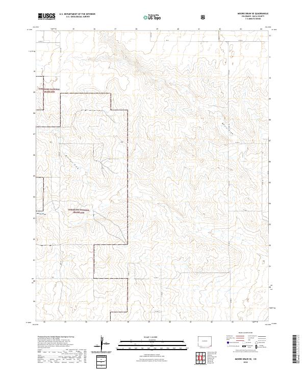
2022 Map of Moore Draw SE
USGS Topo · Published 2022About this map
Comanche National Grassland dominates this corner of Baca County, where the high plains of southeastern Colorado meet a network of seasonal watercourses. The landscape is defined by the ephemeral paths of Moore Draw, Mitchell Draw, and Murray Draw, which carve subtle topography through the township and range grid. This 2022 survey illustrates a sparsely populated ranching environment where the movement of people and livestock is dictated by an organized network of county roads. A structured lattice of gravel and dirt routes, including Co Rd K and Co Rd G, provides the primary access across the grassland. The absence of dense settlements highlights the vast, open-range character of the region, where land management boundaries like those of t34s r44w and t34s r43w form the primary landmarks for modern property and navigation.
Find a feature on this map
22 named features on this map. Tap any name to fly to it.
Don’t see what you’re looking for? This feature index may not catch every label — zoom into the map to look around manually.
Map Details
Editions of this 2022 Moore Draw SE Map
This is the sole edition of this map. No revisions or reprints were ever made.
Other maps of this area

1892 · Vilas
USGS Topo · 1:125,000

1954 · Dalhart
USGS Topo · 1:250,000

1955 · La Junta
USGS Topo · 1:250,000

1958 · La Junta
USGS Topo · 1:250,000

1958 · Dalhart
USGS Topo · 1:250,000

1962 · Dalhart
USGS Topo · 1:250,000

1968 · La Junta
USGS Topo · 1:250,000

1971 · Keyes NW
USGS Topo · 1:24,000

1971 · Keyes NE
USGS Topo · 1:24,000
1971 · Sturgis NW
USGS Topo · 1:24,000