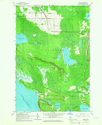
1964 Map of Moran
USGS Topo · Published 1966About this map
The Soo Line railroad cuts a straight path through the eastern Upper Peninsula, anchoring the small settlements of Moran and Allenville during the mid-1960s. This survey reveals a landscape defined by the expansive Summerby Swamp and the varied timberlands of the Hiawatha National Forest. Local history is preserved in the location of the Zion Ch, the Brevoort Cem, and the Immaculate Conception Cem, reflecting the early religious and community centers of these rural Mackinac County townships.
Find a feature on this map
46 named features on this map. Tap any name to fly to it.
Don’t see what you’re looking for? This feature index may not catch every label — zoom into the map to look around manually.
Map Details
Editions of this 1964 Moran Map
2 editions found
Other maps of this area

1931 · St Ignace NW
USGS Topo · 1:31,680

1931 · Moran NE
USGS Topo · 1:31,680

1931 · Ozark SE
USGS Topo · 1:31,680

1948 · Moran NE
USGS Topo · 1:31,680

1948 · Moran NW
USGS Topo · 1:31,680

1954 · Sault Sainte Marie
USGS Topo · 1:250,000

1955 · Cheboygan
USGS Topo · 1:250,000

1956 · Sault Sainte Marie
USGS Topo · 1:250,000

1957 · Sault Sainte Marie
USGS Topo · 1:250,000

1958 · Cheboygan
USGS Topo · 1:250,000