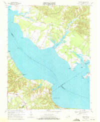
1968 Map of Morattico
USGS Topo · Published 1971About this map
The Rappahannock River bisects this Tidewater landscape, separating the shores of Richmond and Essex counties in the late 1960s. This survey records a river-oriented economy just as modern roads were becoming the primary connectors for small waterfront communities like Sharps and Morattico. Numerous small points and inlets, such as Wilna Pt and Farnham Creek, suggest a history of local maritime activity and sheltered harbors.
Find a feature on this map
45 named features on this map. Tap any name to fly to it.
Don’t see what you’re looking for? This feature index may not catch every label — zoom into the map to look around manually.
Map Details
Editions of this 1968 Morattico Map
2 editions found
Other maps of this area

1917 · Urbanna
USGS Topo · 1:62,500

1917 · Morattico
USGS Topo · 1:62,500

1918 · Tappahannock
USGS Topo · 1:62,500

1918 · Morattico
USGS Topo · 1:62,500

1919 · New Kent
USGS Topo · 1:62,500

1919 · Tappahannock
USGS Topo · 1:62,500

1926 · Morattico
USGS Topo · 1:62,500

1943 · Richmond
USGS Topo · 1:250,000

1944 · Tappahannock
USGS Topo · 1:31,680

1944 · Dunnsville
USGS Topo · 1:31,680