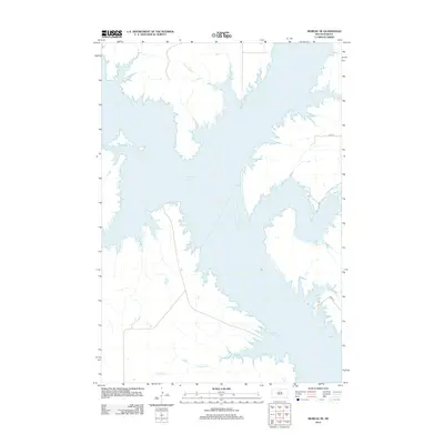
2012 Map of Moreau SE
USGS Topo · Published 2012About this map
Lake Oahe dominates this central South Dakota landscape, its expansive waters filling the Missouri River valley and creating a complex shoreline of inlets and points. Along the northern reaches, the waters of Three Legs Cr flow into the reservoir, while the southern portion is shaped by the mouth of Fielder Cr. The terrain reflects the transition from prairie uplands to the inundated river valley, a landscape dramatically altered by twentieth-century water management projects. Remote section line roads such as 141st St and 146th St provide sparse access to the shoreline, marking the grid of rural Dewey County. This 2012 survey illustrates the relationship between the massive reservoir system and the quiet, undeveloped plains that define the region's geography.
Find a feature on this map
5 named features on this map. Tap any name to fly to it.
Don’t see what you’re looking for? This feature index may not catch every label — zoom into the map to look around manually.
Map Details
Editions of this 2012 Moreau SE Map
This is the sole edition of this map. No revisions or reprints were ever made.
Other maps of this area

1953 · McIntosh
USGS Topo · 1:250,000

1958 · McIntosh
USGS Topo · 1:250,000

1968 · Moreau NW
USGS Topo · 1:24,000

1968 · Moreau NE
USGS Topo · 1:24,000

1968 · Akaska NW
USGS Topo · 1:24,000

1968 · Akaska SW
USGS Topo · 1:24,000

1968 · Moreau
USGS Topo · 1:24,000

1968 · Moreau SE
USGS Topo · 1:24,000

1969 · Four Bear Creek
USGS Topo · 1:24,000

1970 · Steamboat Creek
USGS Topo · 1:24,000