
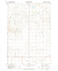
1970 Map of Steamboat Creek
USGS Topo · Published 1972About this map
Lake Oahe dominates the western edge of this 1970 landscape, creating a series of deep inlets including Steamboat Bay, Dodge Bay, and Latin Bay. The map captures the shoreline during a period of transition as the Missouri River reservoir reached its recorded elevation, flooding the lower reaches of Steamboat Creek. The area is organized into distinct rural townships including North Riverside, Fayette, and South Riverside. Educational and civic life is anchored by the Appomattox Sch in the Appomattox district, while the boundary between Walworth and Potter Counties marks the northern extent of the sheet. The terrain transitions from the inundated river valley to the upland plains, illustrating the early impact of the reservoir on the local ranching and farming landscape.
Find a feature on this map
11 named features on this map. Tap any name to fly to it.
Don’t see what you’re looking for? This feature index may not catch every label — zoom into the map to look around manually.
Map Details
Editions of this 1970 Steamboat Creek Map
This is the sole edition of this map. No revisions or reprints were ever made.
Other maps of this area

1953 · McIntosh
USGS Topo · 1:250,000

1958 · McIntosh
USGS Topo · 1:250,000

1968 · Akaska SW
USGS Topo · 1:24,000

1968 · Akaska
USGS Topo · 1:24,000

1968 · Moreau SE
USGS Topo · 1:24,000

1969 · Four Bear Creek
USGS Topo · 1:24,000

1969 · Patch Skin Buttes SE
USGS Topo · 1:24,000

1970 · Lake Hurley
USGS Topo · 1:24,000

1970 · Lake Hurley NE
USGS Topo · 1:24,000
1970 · Lake Hurley SE
USGS Topo · 1:24,000