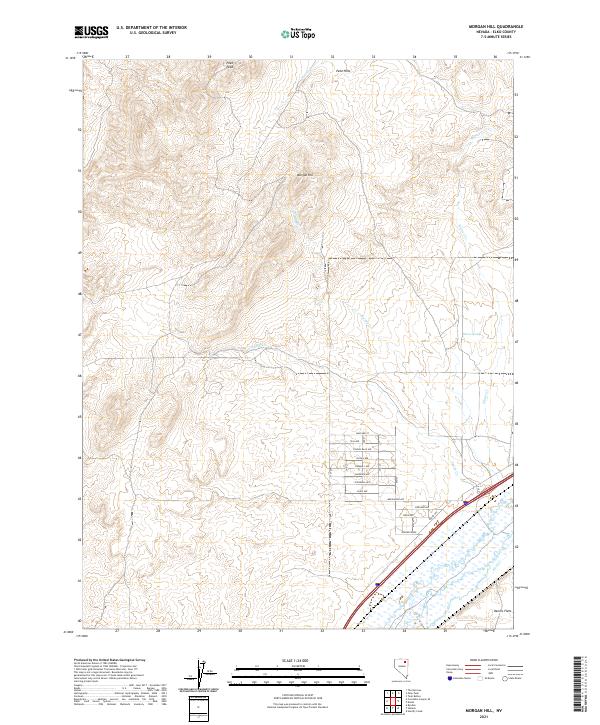
2021 Map of Morgan Hill
USGS Topo · Published 2021About this map
Morgan Hill and the surrounding Peko Hills define this high-desert landscape in Elko County, where seasonal drainage patterns and modern residential development meet the riparian corridor of the Humboldt River. The southern portion of the map reveals a systematic grid of streets named for waterfowl, including Mallard St, Canvas Back Ave, and Spoonbill Ave, illustrating the expansion of residential tracts north of the Interstate 80 corridor.
Find a feature on this map
27 named features on this map. Tap any name to fly to it.
Don’t see what you’re looking for? This feature index may not catch every label — zoom into the map to look around manually.
Map Details
Editions of this 2021 Morgan Hill Map
This is the sole edition of this map. No revisions or reprints were ever made.
Other maps of this area

1935 · Halleck
USGS Topo · 1:125,000

1955 · Wells
USGS Topo · 1:250,000

1955 · Elko
USGS Topo · 1:250,000

1958 · Wells
USGS Topo · 1:250,000

1958 · Elko
USGS Topo · 1:250,000

1961 · Wells
USGS Topo · 1:250,000

1962 · Elko
USGS Topo · 1:250,000

1962 · Ryndon
USGS Topo · 1:24,000

1965 · Elko
USGS Topo · 1:250,000

1967 · Twin Buttes
USGS Topo · 1:24,000