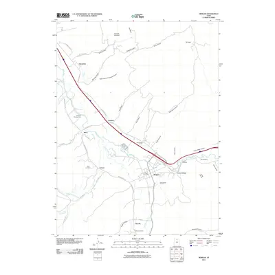
2011 Map of Morgan
USGS Topo · Published 2011About this map
The Weber River valley dominates this landscape, serving as the primary corridor for agriculture and settlement in the early 21st century. The town of Morgan acts as the central hub, supported by the Morgan Post Office and surrounded by smaller rural communities such as Littleton, Milton, and Richville. Water management for the valley is visible through infrastructure like the Stoddard Diversion Dam and Como Diversion, which regulate the river's flow for local use.
Find a feature on this map
57 named features on this map. Tap any name to fly to it.
Don’t see what you’re looking for? This feature index may not catch every label — zoom into the map to look around manually.
Map Details
Editions of this 2011 Morgan Map
This is the sole edition of this map. No revisions or reprints were ever made.
Other maps of this area

1885 · Salt Lake
USGS Topo · 1:250,000

1925 · Ft. Douglas
USGS Topo · 1:125,000

1928 · Ft. Douglas
USGS Topo · 1:125,000

1952 · Bountiful Peak
USGS Topo · 1:24,000

1954 · Salt Lake City
USGS Topo · 1:250,000

1954 · Ogden
USGS Topo · 1:250,000

1955 · Peterson
USGS Topo · 1:24,000

1955 · Snow Basin
USGS Topo · 1:24,000

1958 · Ogden
USGS Topo · 1:250,000

1958 · Salt Lake City
USGS Topo · 1:250,000