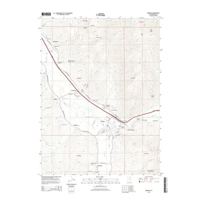
2014 Map of Morgan
USGS Topo · Published 2014About this map
The Weber River defines the corridor of this Utah landscape, providing a narrow fertile valley between the high reaches of the Wasatch Range and the Bear River Range. The city of Morgan serves as the central hub, situated where E Canyon Cr joins the main river channel. This 2014 survey documents the dense concentration of civic and historical sites in the valley floor, including the N Morgan Cem and S Morgan Cem, alongside the recreational area of Como Springs.
Find a feature on this map
82 named features on this map. Tap any name to fly to it.
Don’t see what you’re looking for? This feature index may not catch every label — zoom into the map to look around manually.
Map Details
Editions of this 2014 Morgan Map
This is the sole edition of this map. No revisions or reprints were ever made.
Other maps of this area

1885 · Salt Lake
USGS Topo · 1:250,000

1925 · Ft. Douglas
USGS Topo · 1:125,000

1928 · Ft. Douglas
USGS Topo · 1:125,000

1952 · Bountiful Peak
USGS Topo · 1:24,000

1954 · Salt Lake City
USGS Topo · 1:250,000

1954 · Ogden
USGS Topo · 1:250,000

1955 · Peterson
USGS Topo · 1:24,000

1955 · Snow Basin
USGS Topo · 1:24,000

1958 · Ogden
USGS Topo · 1:250,000

1958 · Salt Lake City
USGS Topo · 1:250,000