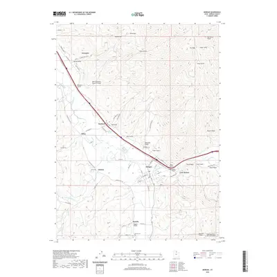
2020 Map of Morgan
USGS Topo · Published 2020About this map
Morgan sits at the heart of this landscape where the Weber River meets E Canyon Cr, anchoring a network of small agricultural and residential settlements. The valley floor is marked by distinct historic communities including Enterprise, Stoddard, and Milton, each connected by roads that trace the natural contours of the Wasatch Range and the Bear River Range. The presence of several dedicated burial grounds, such as North Morgan Cem and Richville Cem, indicates the long-standing family lineages that have shaped this portion of Morgan County.
Find a feature on this map
76 named features on this map. Tap any name to fly to it.
Don’t see what you’re looking for? This feature index may not catch every label — zoom into the map to look around manually.
Map Details
Editions of this 2020 Morgan Map
This is the sole edition of this map. No revisions or reprints were ever made.
Other maps of this area

1885 · Salt Lake
USGS Topo · 1:250,000

1925 · Ft. Douglas
USGS Topo · 1:125,000

1928 · Ft. Douglas
USGS Topo · 1:125,000

1952 · Bountiful Peak
USGS Topo · 1:24,000

1954 · Salt Lake City
USGS Topo · 1:250,000

1954 · Ogden
USGS Topo · 1:250,000

1955 · Peterson
USGS Topo · 1:24,000

1955 · Snow Basin
USGS Topo · 1:24,000

1958 · Ogden
USGS Topo · 1:250,000

1958 · Salt Lake City
USGS Topo · 1:250,000