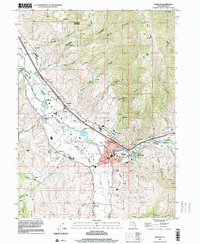
1997 Map of Morgan
USGS Topo · Published 2001About this map
The Weber River carves a fertile corridor through northern Utah, serving as the central artery for a series of mountain-valley settlements in the late 1990s. The city of Morgan acts as the regional hub, situated where East Canyon Creek meets the main river channel. This area is defined by its agricultural and transit infrastructure, including the Union Pacific railroad line that parallels the river and the Stoddard Diversion Dam which manages the local water flow.
Find a feature on this map
60 named features on this map. Tap any name to fly to it.
Don’t see what you’re looking for? This feature index may not catch every label — zoom into the map to look around manually.
Map Details
Editions of this 1997 Morgan Map
This is the sole edition of this map. No revisions or reprints were ever made.
Other maps of this area

1885 · Salt Lake
USGS Topo · 1:250,000

1925 · Ft. Douglas
USGS Topo · 1:125,000

1928 · Ft. Douglas
USGS Topo · 1:125,000

1952 · Bountiful Peak
USGS Topo · 1:24,000

1954 · Salt Lake City
USGS Topo · 1:250,000

1954 · Ogden
USGS Topo · 1:250,000

1955 · Peterson
USGS Topo · 1:24,000

1955 · Snow Basin
USGS Topo · 1:24,000

1958 · Ogden
USGS Topo · 1:250,000

1958 · Salt Lake City
USGS Topo · 1:250,000