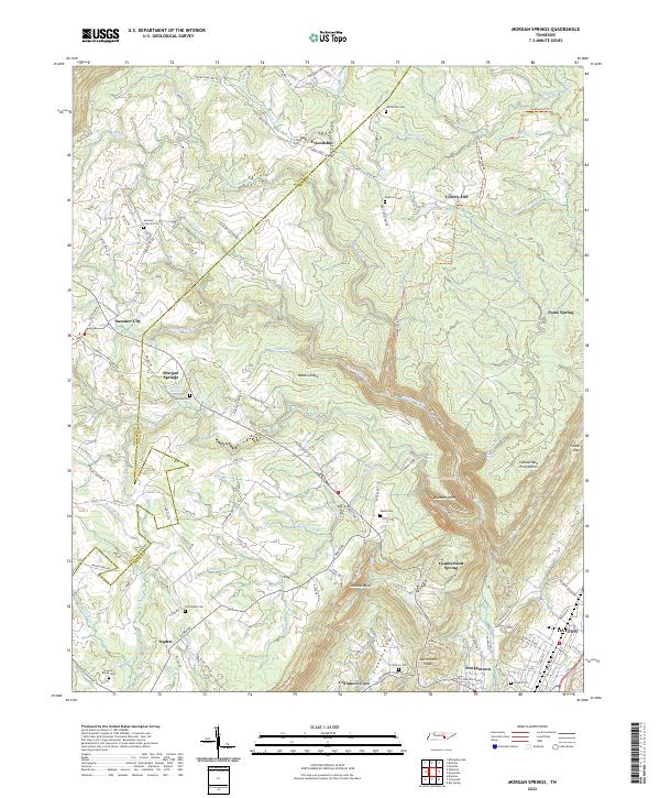
2022 Map of Morgan Springs
USGS Topo · Published 2022About this map
Walden Ridge dominates this portion of the Cumberland Escarpment, where the high plateau drops toward the Tennessee River Valley. The boundary between Bledsoe and Rhea counties runs through a landscape marked by small, upland settlements like Summer City, Morgan Springs, and Ogden. These communities are connected by a network of family-named roads such as Cyrus Daniel Rd and Nelson Harrison Rd, illustrating a settlement pattern of dispersed rural homesteads.
Find a feature on this map
123 named features on this map. Tap any name to fly to it.
Don’t see what you’re looking for? This feature index may not catch every label — zoom into the map to look around manually.
Map Details
Editions of this 2022 Morgan Springs Map
This is the sole edition of this map. No revisions or reprints were ever made.
Other maps of this area

1886 · Cleveland
USGS Topo · 1:125,000

1887 · Kingston
USGS Topo · 1:125,000

1888 · Chattanooga
USGS Topo · 1:125,000

1891 · Kingston
USGS Topo · 1:125,000

1892 · Pikeville
USGS Topo · 1:125,000

1892 · Cleveland
USGS Topo · 1:125,000

1893 · Chattanooga
USGS Topo · 1:125,000

1893 · Kingston
USGS Topo · 1:125,000

1895 · Cleveland
USGS Topo · 1:125,000

1895 · Pikeville
USGS Topo · 1:125,000