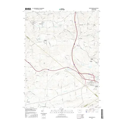
2016 Map of Morgantown
USGS Topo · Published 2016About this map
Joanna Furnace stands as a prominent landmark in this 2016 survey, reflecting the industrial heritage of the Berks and Lancaster county borderlands. The landscape is characterized by a dense concentration of faith-based burial grounds and settlements that speak to the area's deep religious and genealogical history. From Churchtown in the south to Alleghenyville in the north, the map meticulously records various denominational sites including the Alleghenyville Mennonite Cem, Robeson Monthly Meeting Cem, and Saint Thomas Episcopal Church Cem.
Find a feature on this map
171 named features on this map. Tap any name to fly to it.
Don’t see what you’re looking for? This feature index may not catch every label — zoom into the map to look around manually.
Map Details
Editions of this 2016 Morgantown Map
This is the sole edition of this map. No revisions or reprints were ever made.
Other maps of this area

1894 · Reading
USGS Topo · 1:62,500

1902 · Wernersville
USGS Topo · 1:62,500

1905 · Honey Brook
USGS Topo · 1:62,500

1906 · New Holland
USGS Topo · 1:62,500

1907 · Honeybrook
USGS Topo · 1:62,500

1908 · New Holland
USGS Topo · 1:62,500

1913 · Reading
USGS Topo · 1:62,500

1915 · Reading
USGS Topo · 1:62,500

1941 · Honeybrook
USGS Topo · 1:62,500

1941 · New Holland
USGS Topo · 1:62,500
Featured Places
- East Earl Township, PA
- New Morgan, PA
- Brecknock Township, PA
- Plowville, Robeson Township
- Beckersville, Robeson Township