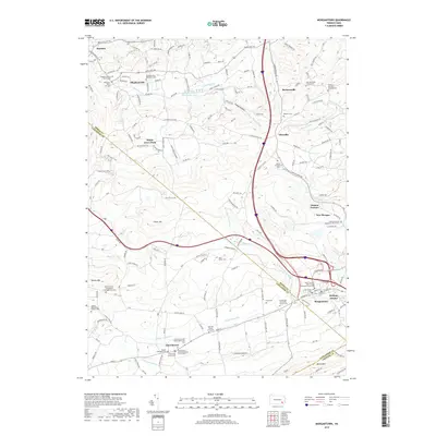
2019 Map of Morgantown
USGS Topo · Published 2019About this map
Morgantown and Churchtown anchor this detailed study of the southeastern Pennsylvania landscape where the Conestoga River headwaters emerge. The map reveals a dense concentration of local religious and genealogical sites, including numerous Mennonite and Episcopal burial grounds such as the Churchtown Old Order Mennonite Cemetery and the Bangor Episcopal Cemetery. The historical industrial heritage of the area is represented by Joanna Furnace in the east, while smaller settlements like Alleghenyville and Plowville dot the northern hills. The terrain is defined by prominent elevations like Welsh Mountain and Silver Hill, which overlook the winding paths of the West Branch Conestoga River and Hay Creek. This survey captures the region's enduring character as a hub of traditional communities and early iron production.
Find a feature on this map
174 named features on this map. Tap any name to fly to it.
Don’t see what you’re looking for? This feature index may not catch every label — zoom into the map to look around manually.
Map Details
Editions of this 2019 Morgantown Map
This is the sole edition of this map. No revisions or reprints were ever made.
Other maps of this area

1894 · Reading
USGS Topo · 1:62,500

1902 · Wernersville
USGS Topo · 1:62,500

1905 · Honey Brook
USGS Topo · 1:62,500

1906 · New Holland
USGS Topo · 1:62,500

1907 · Honeybrook
USGS Topo · 1:62,500

1908 · New Holland
USGS Topo · 1:62,500

1913 · Reading
USGS Topo · 1:62,500

1915 · Reading
USGS Topo · 1:62,500

1941 · Honeybrook
USGS Topo · 1:62,500

1941 · New Holland
USGS Topo · 1:62,500
Featured Places
- East Earl Township, PA
- New Morgan, PA
- Brecknock Township, PA
- Plowville, Robeson Township
- Beckersville, Robeson Township