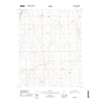
2018 Map of Moriah Knoll
USGS Topo · Published 2018About this map
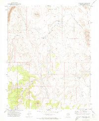
The Hurricane Cliffs dominate the northwestern edge of this high-desert landscape in Mohave County, where the topography transitions into the expansive Lonesome Valley. This region is defined by its significant relief and strategic water management, characterized by numerous stock tanks such as Turn Wash Tank and Shanley Tank that supported ranching operations in a challenging environment. The map details a series of prominent elevations including Moriah Knoll and the Seven Knolls cluster, providing a clear picture of the natural drainage patterns dictated by features like Langs Run and the West Fork Black Canyon. Researchers can find evidence of early water sources like Hualpais Spring, while the inclusion of modern landmarks like Jodys Lake and Dutch Valley reveals how the land was partitioned and utilized for water catchment during the early 21st century.
Find a feature on this map
23 named features on this map. Tap any name to fly to it.
Don’t see what you’re looking for? This feature index may not catch every label — zoom into the map to look around manually.
Map Details
Editions of this 2018 Moriah Knoll Map
This is the sole edition of this map. No revisions or reprints were ever made.
Other maps of this area

1886 · Mt. Trumbull
USGS Topo · 1:250,000

1892 · Mt. Trumbull
USGS Topo · 1:250,000

1953 · Grand Canyon
USGS Topo · 1:250,000

1957 · Grand Canyon
USGS Topo · 1:250,000

1958 · Grand Canyon
USGS Topo · 1:250,000

1960 · Grand Canyon
USGS Topo · 1:250,000
1967 · Mt. Trumbull NE
USGS Topo · 1:24,000
1967 · Mt. Trumbull NW
USGS Topo · 1:24,000
1971 · Antelope Knoll
USGS Topo · 1:24,000
1971 · Moriah Knoll
USGS Topo · 1:24,000